Sync Dispatch Map

It might seem obvious if you’re building bus tracking software to put the buses on a map. It’s what our software (and just about every other dispatch software) had done for years, and it’s what nearly every consumer navigation app does as well. From Google Maps to enterprise fleet tracking apps, vehicles appear on a map.
When we embarked on a process to redesign our transit dispatch software from the ground up, we assumed that we’d start with the map. But our discussions with dispatchers led us down a different road entirely.
We put the map redesign on hold and instead built the Dispatch List. The Dispatch List is great at giving transit operators a view of the current state of their system, but some tasks still require a better overview of the town’s geography, so dispatchers would often have to return to the old map-based tools as well.
Today, we’re proud to launch the completely new companion to the Dispatch List — the Sync Dispatch Map!
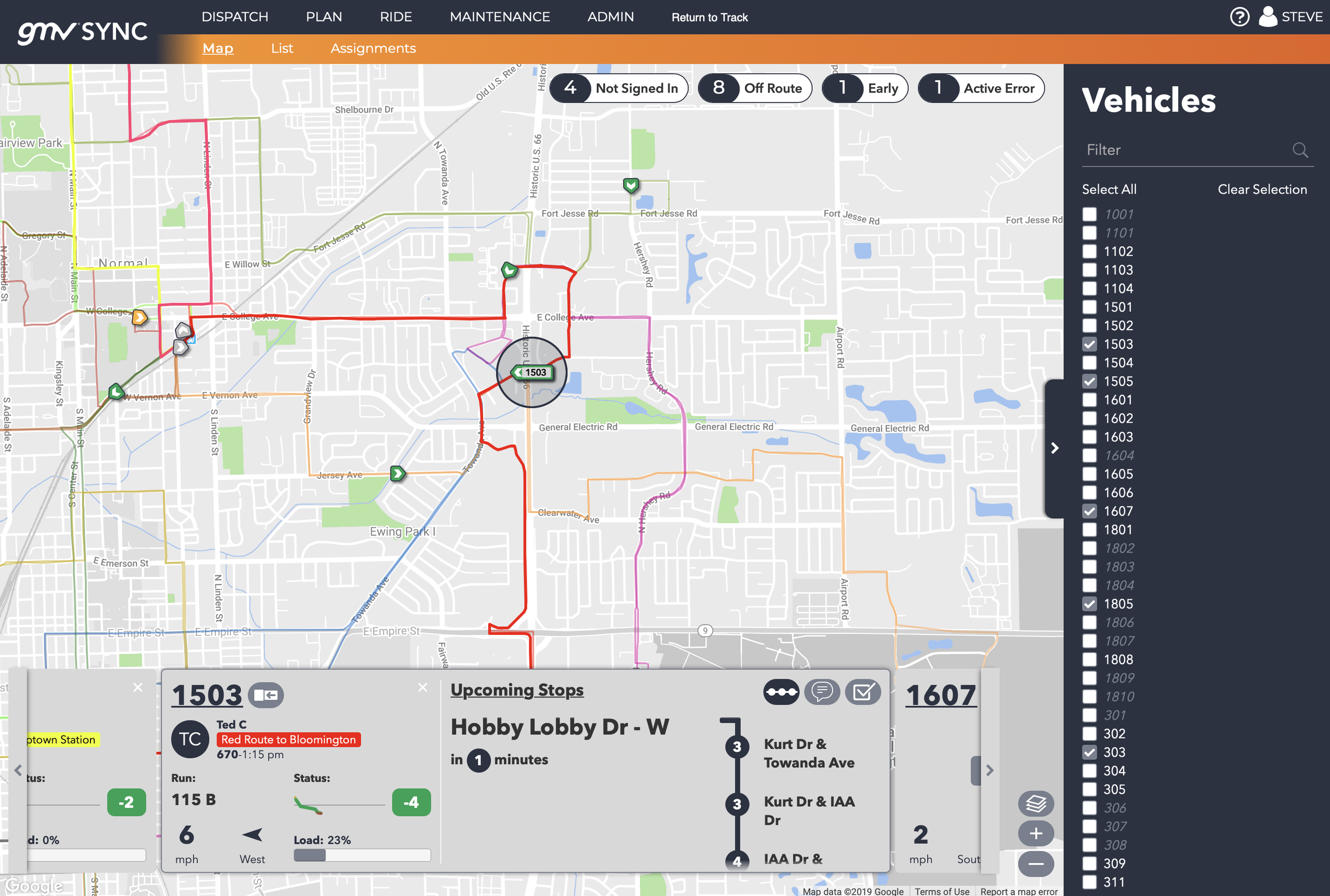
The dispatch map brings your service geography into view.
The Dispatch Map puts all of the List’s familiar tools, plus some first of its kind features, right at your fingertips.
Action Cards allow a dispatcher to see a bus’s upcoming stops (and possible missed connections), initiate a voice call with one or many drivers, or even take a live view of the security cameras on board.

New action cards on both the Dispatch Map and Dispatch List include the ability to see a live view of security cameras and the option to make a voice call with the driver of one or more vehicles.
Just like with the list, the vehicles in view can be filtered with Status Pills, so you only see the vehicles needing attention, or you can search using the intelligent Sidebar.
The map and list views are completely integrated, so they remember what you’re looking at when you switch between them.

Switching between the list and map views is easy when we remember exactly what vehicle and action card you’re looking at.
Open an Action Card on the list view, switch to the map for greater context and you’ll see the same vehicle and action card focused in the center. You can then switch to another action card, focus on a different vehicle, or move back to the list view as you please without losing your place.
On its face, a map view of moving vehicles is not so innovative — but paired with the Dispatch List, Status Pills, and our ever expanding selection of Action Cards, the Sync Dispatch Map provides dispatchers with more tools in one place than ever before.
These tools provide transit operators with a vastly improved workflow thanks in large part to the participants in our beta program, who helped us design and refine the features. Special thanks to Connect Transit, Coralville, Iowa City, Marin Transit, Maui Bus, Rock Region Metro, all of our friends in South Carolina (Greenlink, Palmetto Breeze, Pee Dee RTA, Santee Wateree RTA, TriCountyLink), Towson University, and the University of Iowa CAMBUS for your feedback and participation.
We’re excited to release the Dispatch Map to all customers today, and we have plenty of new features still in store and coming to the dispatch experience soon.
If you’re a GMV customer and want more information about joining our beta program for early access to new features, contact us at beta@gmvsync.com.